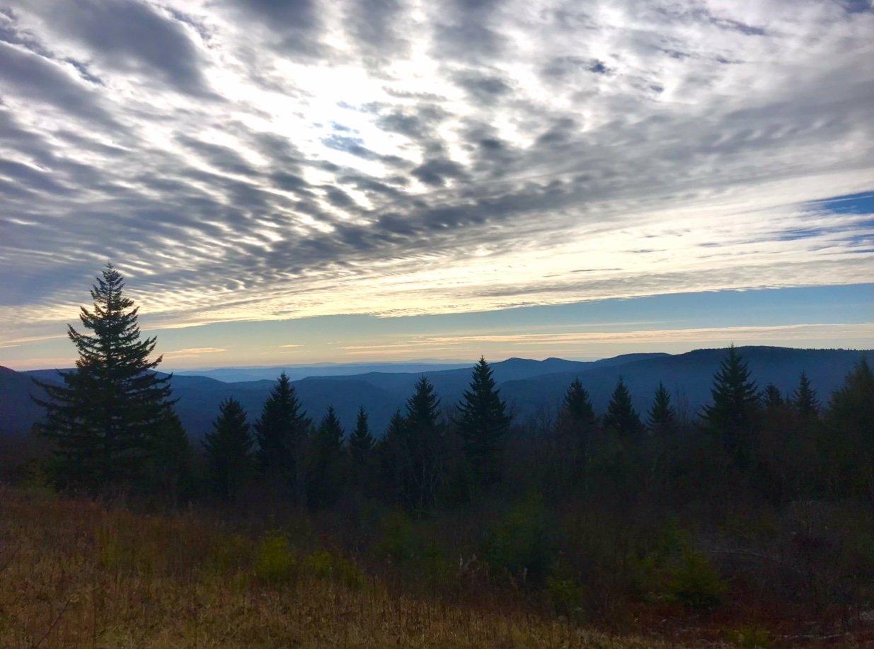

wv trail running guide
Looking for trails and routes in New River Gorge National Park, the Cranberry Wilderness, & the southern Monongahela National Forest? Well this is your spot! Our goal is to get you all the info, photos, maps, & more on some of our favorite routes and places to run. Great for setting up training runs, going for an FKT, or to simply get out and explore some new trails. Get the insider info and then get out there and enjoy these amazing landscapes!
NEW RIVER GORGE ROUTES:
- New River Gorge Traverse (49 miles)
- Short Creek Loop (7.5 miles)
- Kaymoor Miners Infinity Loop (10.7 miles)
- Grandview/Glade Creek Loop (25 miles)
- Run/Raft Loop from Fayette Station (22 miles)
CRANBERRY WILDERNESS ROUTES:
- Cranberry Wilderness Tour (43.25 Miles)
- Cranberry Wilderness Outer Loop (28 miles)
- North Fork/Middle Fork Loop (23 miles)
- Big Beechy/North South Loop (21.5 miles)
- Big Beechy/Middle Fork Loop (18.5 miles)
MONONGAHELA NATIONAL FOREST ROUTES:
-Tea Creek Wildlife Management Area (31 miles)
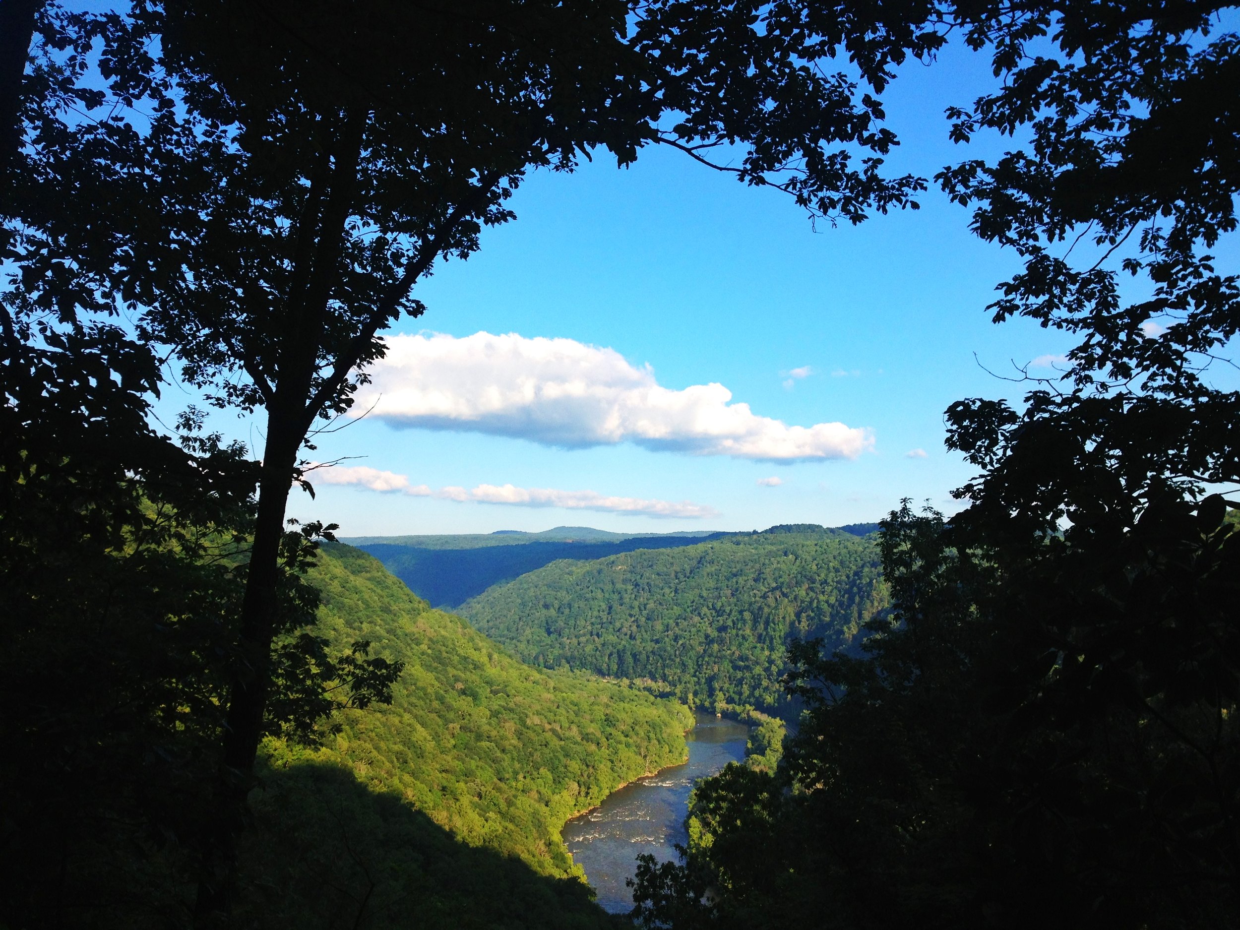
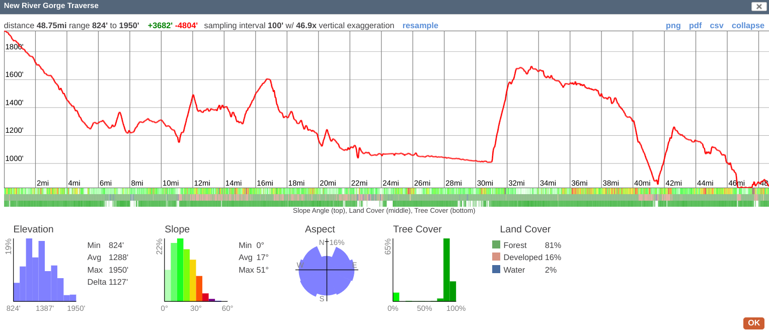
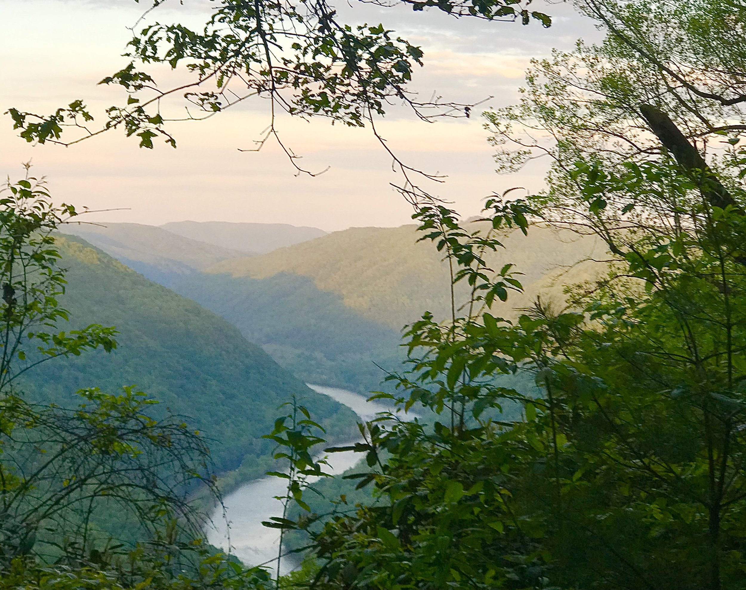
NEW RIVER GORGE traverse
Distance: 49 miles
Directions: This route can be run from South to North(starting at Upper Glade Creek) or North to South(starting at Cotton Hill Bridge). To start at Glade Creek, travel south on US Route 19 on get on I-64 East. Take Exit 129A and follow road for about .5 miles. Turn left on Scott Branch Rd. This road becomes dirt and accesses all the way down to the Upper Glade Creek Trailhead. The road is steep and rocky in some sections, and though 4-wheel drive is not required, low-clearance vehicles may have problems. To start at Cotton Hill Bridge, take HWY-16 North out of Fayetteville towards the town of Gauley Bridge. Parking is just after you cross over the New River on Cotton Hill Bridge.
Google Maps: https://goo.gl/maps/qLmHvihsSrXQDP1d9 , https://goo.gl/maps/aJC6QscJdJP49tZq8
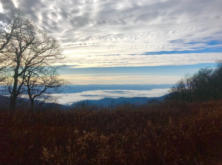
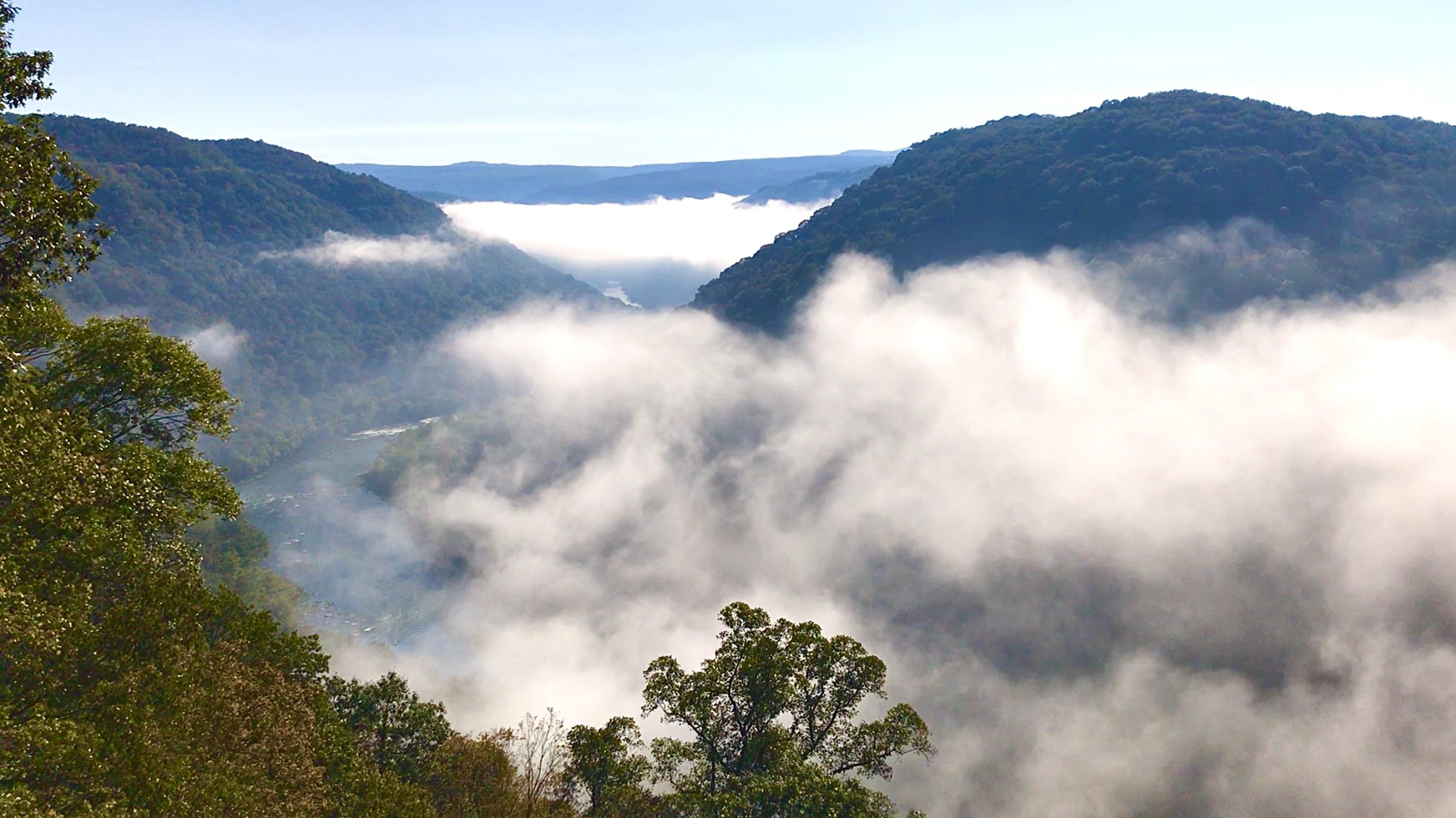
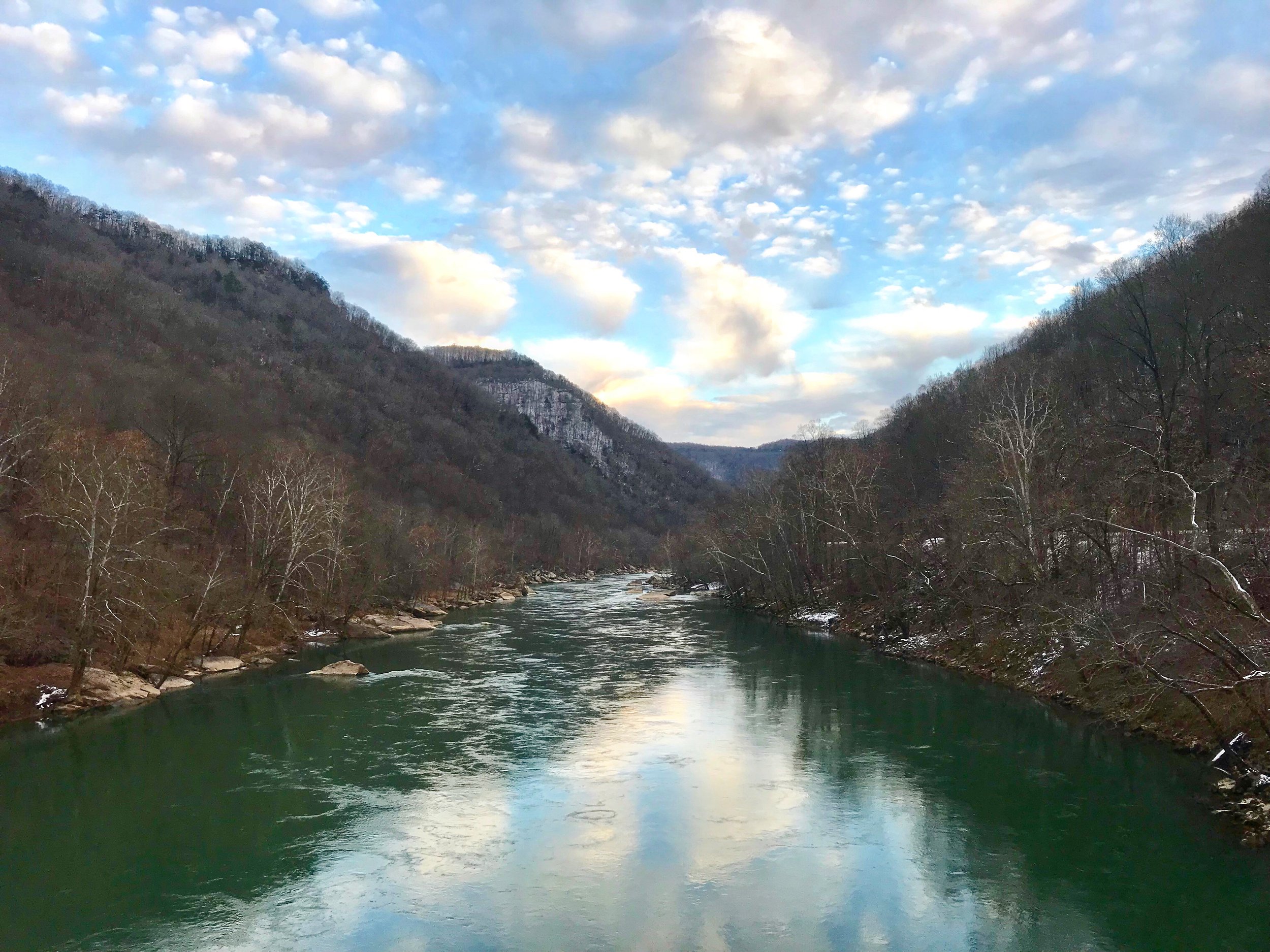
Description: This is the longest (while also being the most direct) point-to-point route across the New River Gorge, combining trails and dirt roads with a few short stretches of pavement to connect trailheads. From the Upper Glade Creek Trailhead, enjoy 6 miles following Glade Creek down to its junction with the New River(a short .25 mile jaunt to see Kate’s Falls is worth it!) At the parking area at the Lower Glade Creek Trailhead, turn left on the dirt road and follow for 5 miles. Cross over the New River on the Thomas Buford Pugh Memorial Bridge and stay on HWY-41 for a few hundred yards until you see the sign for McKendree Rd on the left. Follow McKendree Rd. up the steep climb over the saddle and then along the ridge and back down to the New River for 11 miles. McKendree Rd. is dirt, much of it sparsely maintained, and is probably the most remote road in the entire park. In the fall and winter, it provides for some spectacular views into the Upper New River Gorge. Cross the New River again, this time using the Stone Cliff Bridge. Follow the paved road for 1.5 miles to the to get on the Southside Junction Trail near the Thurmond Bridge. The Southside Trail follows along the banks on the New River for 7 miles all the way to Cunard. From the large, paved parking area, make the 1.5 mile climb up the paved road to the Kaymoor Trailhead on the right. Follow the Kaymoor Trail for 8 miles to its junction with Fayette Station Rd. Turn right(downhill) on Fayette Station Rd. and follow to the Tunney Hunsaker Bridge, crossing the New River once again, and then continue climbing up Fayette Station Rd. for another 1.5 miles. Take the dirt road on the left and follow it for about .5 mile to find the Hawks Nest Connector Trail on your right. Follow this awesome single-track trail to the base of Hawks Nest State Park and its famous tram cars. Go past the tram station, crossing over Mill Creek, and continue traveling North through the parking area to another trail the runs along the bank of Hawks Nest Lake and to the Hawks Nest Dam. Once past the dam, use the dirt access road to continue heading downstream(north) to the Cotton Hill Bridge parking area and the end of the route.

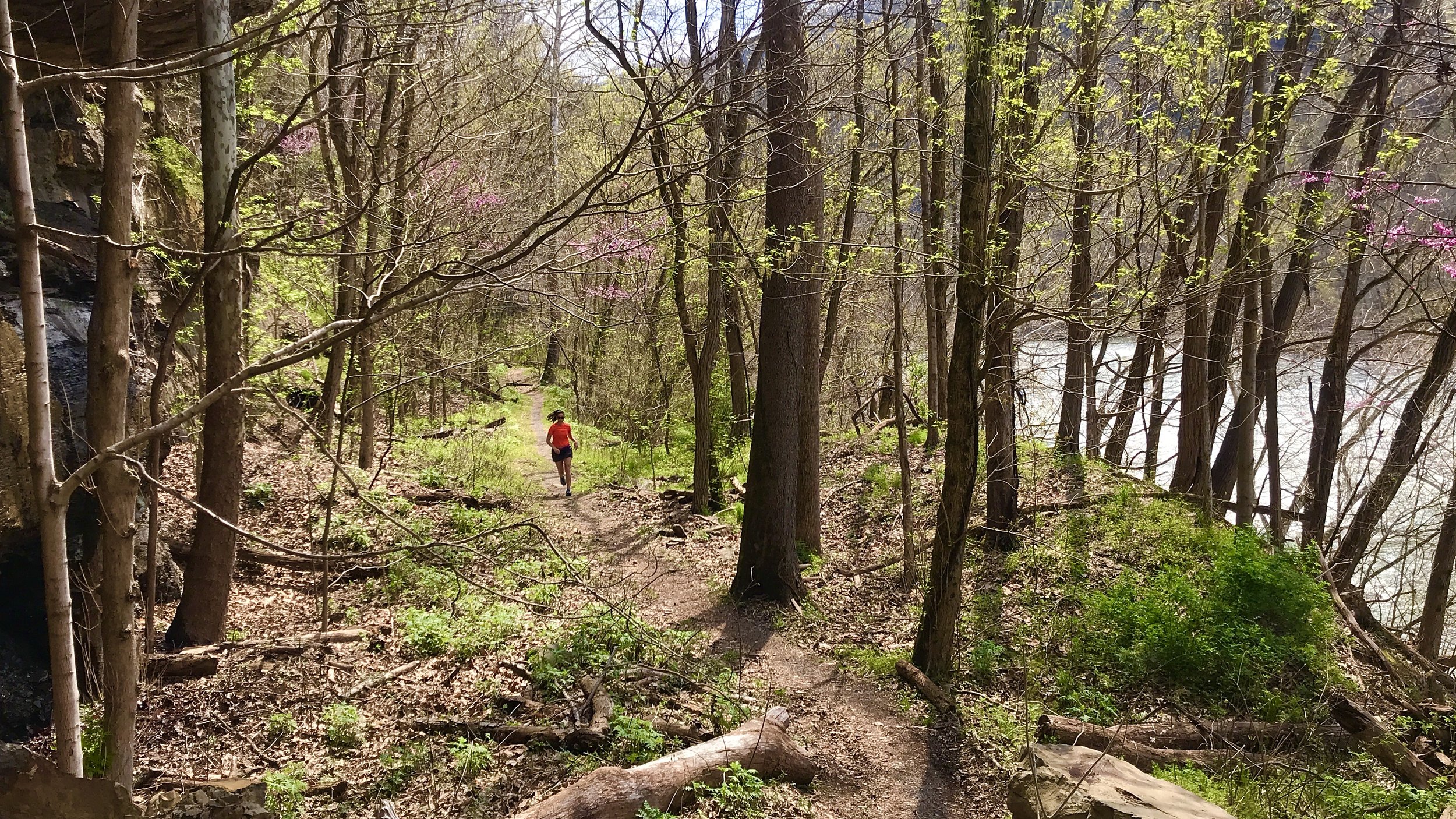
SHORT CREEK LOOP, NEW RIVER GORGE NATIONAL PARK
Distance: 7.5 miles
Time of Year: December - March (large sections are unmaintained and overgrown during spring/summer/fall)
Directions: On US Route 19, travel north over the New River Gorge Bridge. Turn right on Lansing/Edmond Road. Turn right on Beury Mountain Rd. and see the trailhead parking down the dirt road to the left.
Google Maps: https://goo.gl/maps/DndoM88ZLtyr6QaYA
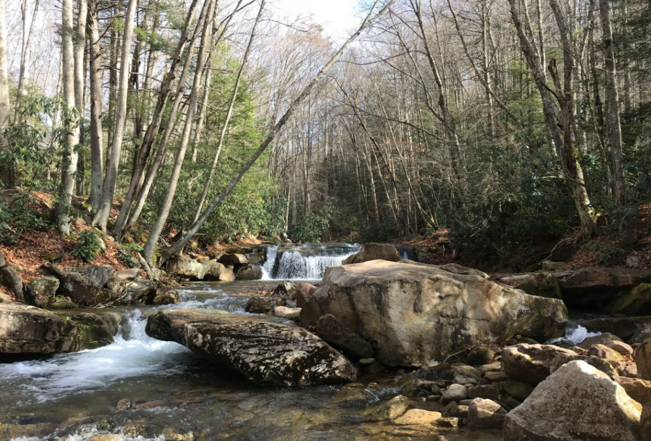
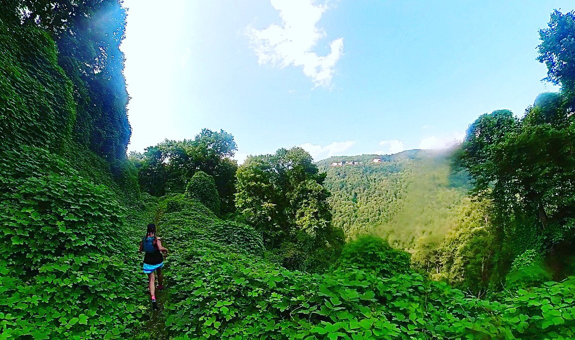
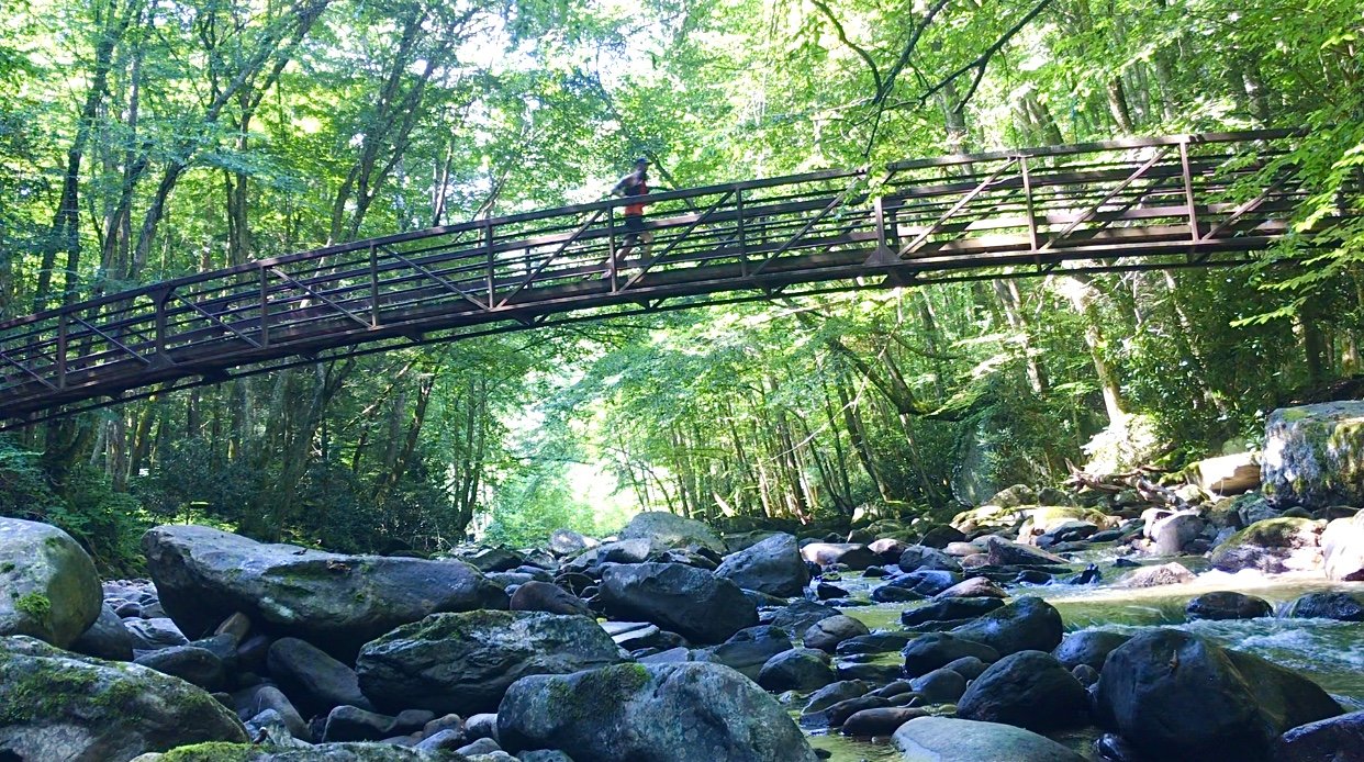
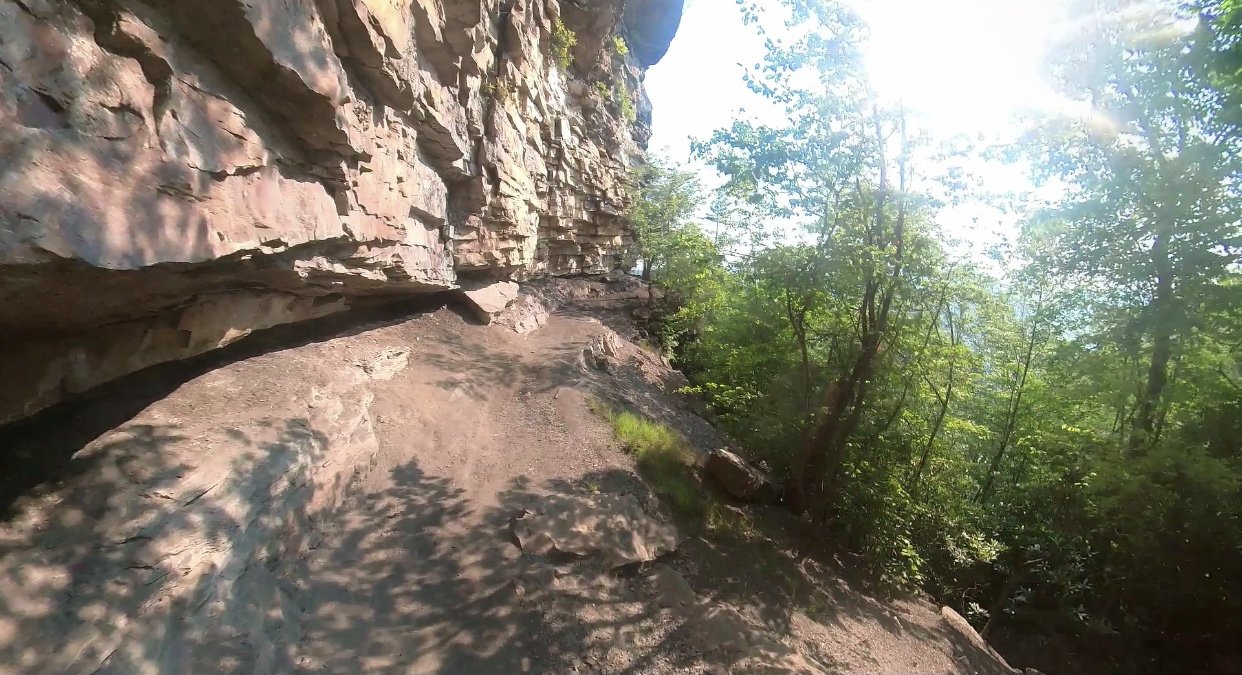
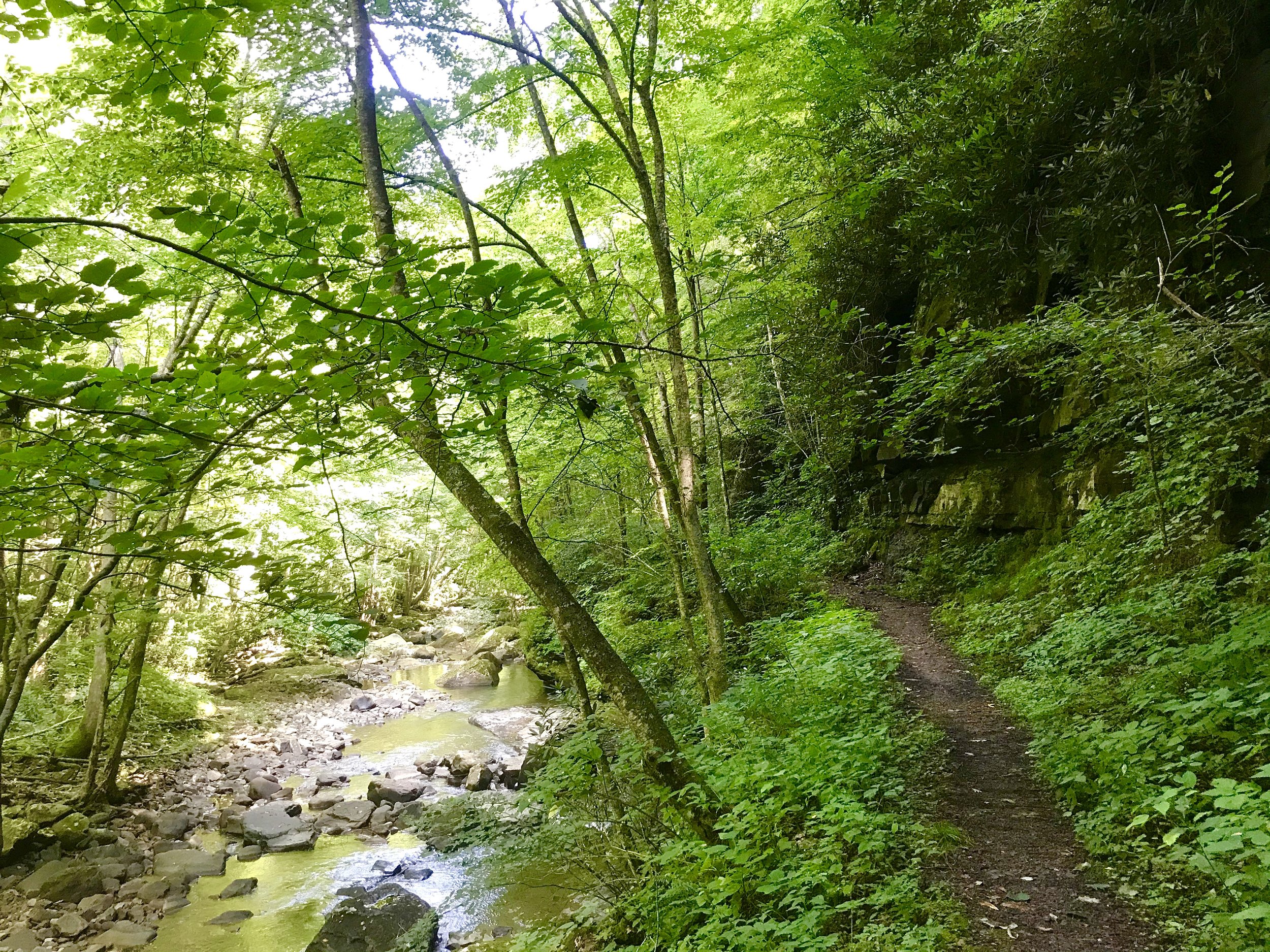
Desription: Technically a “lollipop,” this route starts at the Short Creek Trailhead. Frequented by rock climbers to access the cliffs and rock formations near the rim, the Headhouse Trail drops quickly down into the Gorge. After about a half mile, the wide path takes you to the Nuttallburg Mine where you can checkout the Headhouse and the Tipple (the only standing tipple left in the park) stretching all the way down the town of Nuttalburg near the banks of the New River. Just past this spot, the trail quickly becomes narrow, steep single track. The sectioin is know as the Conveyor Trail which has numurous switchbacks, zigging and zagging its way down the steep sides of the Gorge. Just after the one mile mark, the trail dead ends into a abandoned, unmaintained railroad grade. Follow this old railroad grade heading south for almost 2.5 miles. This section is completely unmaintained and is one of the more remote parts of the park, offering sweeping views of the New River, across to the Kaymoor Trail, and the beautiful waterfalls along Short Creek. There are multiple wooden bridegs along this section. Althought they are stucturallly sound, being built for and used by the railroad, they have seen significant decay to the top wooden parts. Take extreme caution when crossing these bridges as many of them have rotten and/or missing boards. Near mile 3.5, take the dirt double-track to the right to meet up with Keeney Creek Road. Follow this paved road and Keeney Creek all the way down to the New River, enjoying some of the best waterfalls in the entire park. The road will turn to gravel as it heads north along the New River. This road will lead you to the ghost town of Nuttallburg, where you’ll climb back up to the junction with the railroad grade and the Conveyor Trail. Make the steep, switchback climb all the way back to the trailhead to finish off the route.


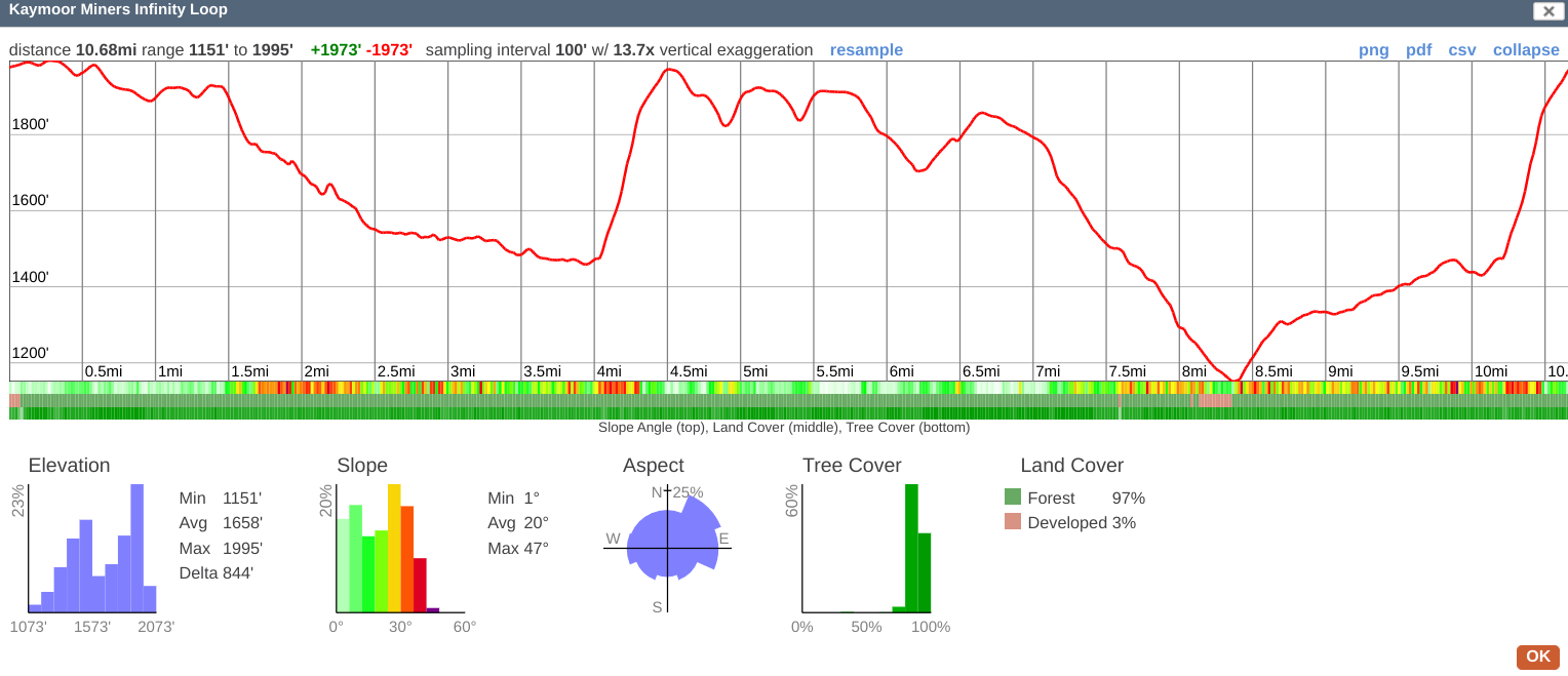
Kaymoor Miners infinity loop, new river gorge national park
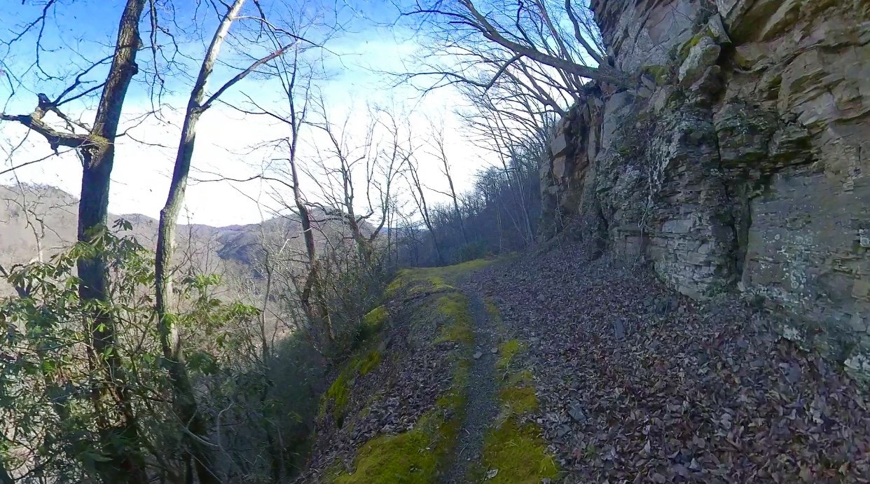
Distance: 10.7 miles
Directions: From downtown Fayetteville, head through town on Court St. and turn left on Gatewood Rd. Turn left on Kaymoor Rd., just past the Arrowhead Bike Farm. Park near the Kaymoor Miners Trailhead.
Google Maps: https://goo.gl/maps/QYXz7WbWNPfesfcU7
Description: A great route for training or just to get on some awesome trails in the New River Gorge, the Kaymoor Miners Infinity Loop allows you to get in some great variety, good climbs and decsents, all while having your car stay in one spot. The route is set up to finish each loop with a climb up the Kaymoor Miners Trail, one of the steepest trails in the park. Start from the Kaymoor Miners Trailhead and head south on the dirt road towards the Arrowhead Trails parking area. Join the Craig Branch Trail at the brown gate andf follow it fo 2 miles to its junction with the Kaymoor Trail. Turn left on the Kaymoor Trail and follow it to the Kaymoor Mine Ruins and the Kaymoor Miners Trail. Begin the steep 500+ foot climb in .6 miles back to the trailhead where you started. Turn right through the parking area and get on the Fayetteville Trail. Follow the Fayetteville Trail for just under 4 miles to its junction with Fayette Station Rd. Turn right and take you immediate right at the Wolf Creek Trailhead to get back on the Kaymoor Trail. Cross the beautiful Wolf Creek and go for 2 miles to arrive back at the base of the Kaymoor Miners Trail. Finish with climb! Repeat in proportion to your masochistic tendencies or need of training!

GRANDVIEW/GLADE CREEK LOOP, NEW RIVER GORGE NATIONAL PARK
Distance: 25 miles
Directions: On US Route 19, travel south and get on I-64 east. Take the Grandview Rd. exit and follow it to the Grandview Overlook area of New River Gorge National Park.
Google Maps: https://goo.gl/maps/yG6dJGkxJL4UQF8j8
Description: This loop has it all . . . epic expansive views from the rocky outcroppings at Grandview, riverside running down along the New River, and countless waterfalls while making your way through the Glade Creek drainage. This loop can be done in either direction. Grandview Rd. is paved, so often the deciding factor is whether you prefer to finish with this paved section(clockwise) or get it over with at the start(counter-clockwise). In the “clockwise” direction, begin at the main overlook parking area at Grandview. Take in the view from the main overlook, and then get on the Castle Rock Trail. Enjoy the beautiful rocks formations and amazing exposure and views. Connect with the Grandview Rim Trail and turn right, follow it all the way to Turkey Spur Rock. The climb up to the observation deck is totally worth it with 360 degree views of the New River Gorge. Take the Turkey Spur Rd. until it “Ts” into another pved road. Turn right and follow it to the back of the parking area where you will see the Little Laurel Trail. Drop 2.5 miles all the way down to the New River on the Little Laurel Trail and turn right on the dirt road at the bottom. Follow this dirt road upstream for 5.5 miles along the New River to the Glade Creek Trailhead on your right. Make your way up the waterfall strewn drainage for about 6 miles where you will come to a small parking area. Cross the bridge over Glade Creek and climb the dirt road for 1.75 miles all the way to it’s junction with Grandview Rd. Take a right, folloing Grandview Rd. for just under 6 miles back the main overlook parking area.


RUN/RAFT LOOP, NEW RIVER GORGE NATIONAL PARK
Distance: 22 miles total (15 miles running/ 7 miles paddling)
Directions: On US Route 19, head North over the New River Gorge Bridge. Turn right on Lansing/Edmond Rd. Turn right on Fayette Station Rd. Route begins and end at Fayette Station river access.
Google Maps: https://goo.gl/maps/6GNWKFVf4jhhGeNM8
Desription: If you have the paddling skills to safely do the river portion of this route, then this just might be the absolute best way to experience New River Gorge National Park in a single outting. The route begins at the Fayette Station river access. Run up Fayette Station Rd. on the south side of the Gorge for 1.2 miles and then find the Fayetteville Trail on your left. Follow the Fayetteville Trail to its junction with Park Loop Trail. Turn right and make the loop, then taking a right to join back with the Fayetteville Trail all the way to the Long Point Trailhead. Follow the Long Point Trail to the Butcher Branch Trail and take a right. This will lead you to the Kaymoor Top Parking Area. Cut across parking area and follow dirt road to the Arrowhead Trails area where you will get on the Craig Branch Trail. Follow the Craig Branch Trail to its junction with the Kaymoor Trail. Turn right on the Kaymoor Trail and follow it all the way to the Cunard Access Rd. Drop down the road to the Cunard River Access. Here’s where your paddling adventure starts, through the heart of the New River Gorge over the course of 7 miles and 20 rapids! Finish back at Fayette Station.


Cranberry Wilderness TOur